
Palm City topographic map
Interactive map
Click on the map to display elevation.
About this map
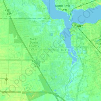
Name: Palm City topographic map, elevation, terrain.
Location: Palm City, Martin County, Florida, 34990, United States (27.11767 -80.33182 27.22541 -80.25076)
Average elevation: 20 ft
Minimum elevation: -13 ft
Maximum elevation: 46 ft
Martin County trails, hiking, mountain biking, running and outdoor activities
Other topographic maps
Click on a map to view its topography, its elevation and its terrain.
Jensen Beach
United States > Florida > Martin County > Jensen Beach
The Skyline Drive area includes some of the highest points in the community, reaching an elevation of 70 feet (21 m) at one point.
Average elevation: 16 ft
Jensen Beach
United States > Florida > Martin County > Jensen Beach
The Skyline Drive area includes some of the highest points in the community, reaching an elevation of 70 feet (21 m) at one point.
Average elevation: 16 ft