
Bigfork topographic map
Interactive map
Click on the map to display elevation.
About this map
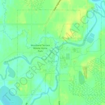
Name: Bigfork topographic map, elevation, terrain.
Location: Bigfork, Itasca County, Minnesota, United States (47.73577 -93.66775 47.75777 -93.63526)
Average elevation: 1,319 ft
Minimum elevation: 1,289 ft
Maximum elevation: 1,352 ft
Itasca County trails, hiking, mountain biking, running and outdoor activities
Other topographic maps
Click on a map to view its topography, its elevation and its terrain.
Wagon Wheel Mobile Home Park
United States > Minnesota > Itasca County > Grand Rapids
Average elevation: 1,345 ft