Geolocate

Village of Addison topographic map

Interactive map

Click on the map to display elevation.

About this map

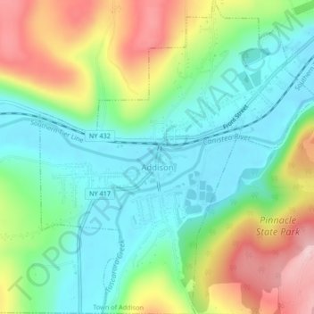
Name: Village of Addison topographic map, elevation, terrain.

Location: Village of Addison, Town of Addison, Steuben County, New York, United States (42.09073 -77.24957 42.12147 -77.21287)

Average elevation: 1,224 ft

Minimum elevation: 958 ft

Maximum elevation: 1,709 ft

Steuben County trails, hiking, mountain biking, running and outdoor activities

Other topographic maps

Click on a map to view its topography, its elevation and its terrain.

Marshalls

United States > New York > Steuben County > Town of Wheeler

Average elevation: 1,526 ft

Painted Post

United States > New York > Steuben County

Average elevation: 1,089 ft

Hornby

United States > New York > Steuben County

Average elevation: 1,742 ft

Cameron

United States > New York > Steuben County

Average elevation: 1,512 ft

Atlanta

United States > New York > Steuben County

Average elevation: 1,493 ft

Hartsville

United States > New York > Steuben County

Average elevation: 1,854 ft

Pulteney

United States > New York > Steuben County

Average elevation: 1,047 ft

Troupsburg

United States > New York > Steuben County > Troupsburg

The southern town line is the border with Pennsylvania (Tioga County). The town is known for higher elevation than other towns in the county.

Average elevation: 1,785 ft

Greenwood

United States > New York > Steuben County > Greenwood

Average elevation: 1,896 ft

Cameron Mills

United States > New York > Steuben County

Average elevation: 1,411 ft