
Avon topographic map
Interactive map
Click on the map to display elevation.
About this map
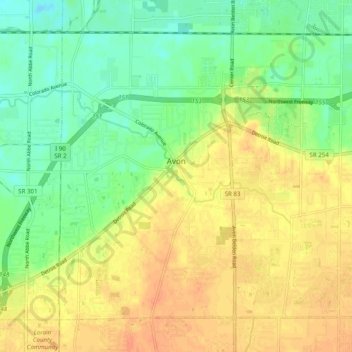
Name: Avon topographic map, elevation, terrain.
Location: Avon, Lorain County, Ohio, 44011, United States (41.41834 -82.06797 41.47864 -81.96945)
Average elevation: 663 ft
Minimum elevation: 597 ft
Maximum elevation: 722 ft
Lorain County trails, hiking, mountain biking, running and outdoor activities
Other topographic maps
Click on a map to view its topography, its elevation and its terrain.