
Apalachicola River topographic map
Interactive map
Click on the map to display elevation.
About this map
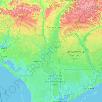
Name: Apalachicola River topographic map, elevation, terrain.
Location: Apalachicola River, Liberty County, Florida, United States (29.72098 -85.15299 30.70232 -84.85808)
Average elevation: 75 ft
Minimum elevation: -13 ft
Maximum elevation: 331 ft
Liberty County trails, hiking, mountain biking, running and outdoor activities
Other topographic maps
Click on a map to view its topography, its elevation and its terrain.