
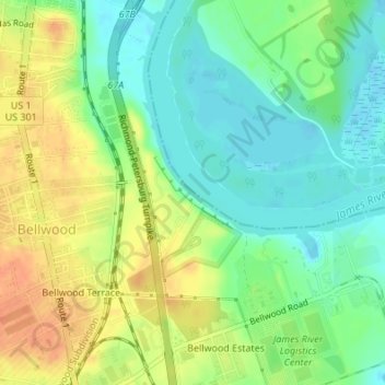
Drewrys Bluff topographic map
Interactive map
Click on the map to display elevation.
About this map
Name: Drewrys Bluff topographic map, elevation, terrain.
Average elevation: 59 ft
Minimum elevation: -7 ft
Maximum elevation: 135 ft
Other topographic maps
Click on a map to view its topography, its elevation and its terrain.
Poquoson
United States of America > Virginia > Poquoson
Additionally, the geographic location of the city, with respect to the principal storm tracks, is generally favorable, as it is south of the usual path of storms originating in the higher latitudes, and north of the usual tracks of hurricanes and other major tropical storms. However, when in the path of a…
Average elevation: 7 ft
Michaelwood
United States of America > Virginia > Virginia Beach > Michaelwood
Average elevation: 16 ft
Charlestown Lakes South
United States of America > Virginia > Charlestown Lakes South
Average elevation: 26 ft
Inland Colony
United States of America > Virginia > Chesapeake > Inland Colony
Average elevation: 10 ft
Broyhill-Glen Gary Park
United States of America > Virginia > Broyhill-Glen Gary Park
Average elevation: 299 ft
Mount Pleasant
United States of America > Virginia > Chesapeake > Mount Pleasant
Average elevation: 13 ft
Penn Laird
United States of America > Virginia > Harrisonburg > Penn Laird
Average elevation: 1,365 ft
Mulberry Greens
United States of America > Virginia > Culpeper > Mulberry Greens
Average elevation: 443 ft