

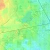
Highland Park topographic map
Click on the map to display elevation.
Highland Park
In 1867, ten men purchased Highland Park for $39,198.70. They were the original stockholders of the Highland Park Building Company. Following construction of the Chicago and Milwaukee Railroad, a depot was established at Highland Park and a plat, extending south to Central Avenue, was laid out in 1856. At that point, Highland Park was settled on mostly scattered farms and undeveloped forested land. Highland Park was established as a city on March 11, 1869, with a population of 500, and evolved from the two settlements of St. John and Port Clinton; St. John's Avenue and Port Clinton Square are named after the settlements. Highland Park was named from its parklike setting at a lofty elevation relative to the lake, and was given its name from Walter S. Gurnee. The town annexed the village of Ravinia in 1899.
About this map
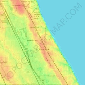
Name: Highland Park topographic map, elevation, terrain.
Location: Highland Park, Lake County, Illinois, United States (42.15226 -87.85206 42.22231 -87.75885)
Average elevation: 636 ft
Minimum elevation: 571 ft
Maximum elevation: 722 ft
Lake County trails, hiking, mountain biking, running and outdoor activities
Other topographic maps
Click on a map to view its topography, its elevation and its terrain.

Illinois Beach State Park
United States > Illinois > Lake County
The park is located in the 12 mile long Zion Beach Ridge Plain. The Zion Beach Ridge Plain is 3,700 years old and composed of curvilinear ridge-and-swale topography. The beach ridges support black oak savanna habitat, while wetlands dominate the swales. The Zion Beach Ridge Plain has been migrating south…
Average elevation: 584 ft


Lake Naomi
United States > Illinois > Lake County > Hawthorn Woods > White Birch Lakes
Average elevation: 856 ft