
Cumming topographic map
Interactive map
Click on the map to display elevation.
About this map
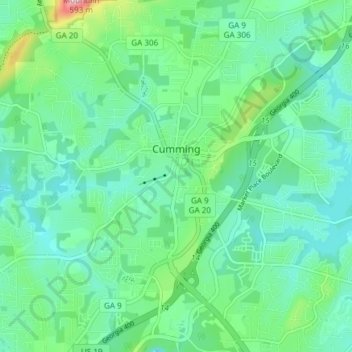
Name: Cumming topographic map, elevation, terrain.
Location: Cumming, Forsyth County, Georgia, United States (34.17157 -84.15790 34.23348 -84.09581)
Average elevation: 1,198 ft
Minimum elevation: 1,027 ft
Maximum elevation: 1,785 ft
Forsyth County trails, hiking, mountain biking, running and outdoor activities
Other topographic maps
Click on a map to view its topography, its elevation and its terrain.