
Himalayas topographic map
Click on the map to display elevation.
Gear up for your next adventure:
As an Amazon Associate, this site earns from qualifying purchases at no extra cost to you.
Himalayas
The Himalayas present a dramatic and varied topography characterized by towering peaks, deep valleys, and extensive glaciers. This majestic mountain range features some of the highest elevations on Earth, including Mount Everest, which rises to 29,035 feet. The terrain is marked by steep, jagged ridges and deep river gorges that have been shaped over millions of years by tectonic activity and glacial processes. The range is divided into several geological zones, including the Greater Himalayas, Lesser Himalayas, and the Siwalik Hills, each exhibiting unique structural formations. The average width of the Himalayas spans about 100 to 150 miles, creating a formidable barrier that influences regional climates and ecosystems. Glaciers are prevalent throughout the range, contributing to numerous rivers that originate in the mountains and flow into the plains below, supporting a rich biodiversity. This complex topography not only provides stunning natural beauty but also plays a crucial role in the ecology and hydrology of the surrounding regions.
About this map
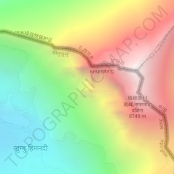
Name: Himalayas topographic map, elevation, terrain.
Average elevation: 24,787 ft
Minimum elevation: 21,155 ft
Maximum elevation: 29,032 ft
Other topographic maps
Click on a map to view its topography, its elevation and its terrain.