
Hernando Beach topographic map
Interactive map
Click on the map to display elevation.
About this map
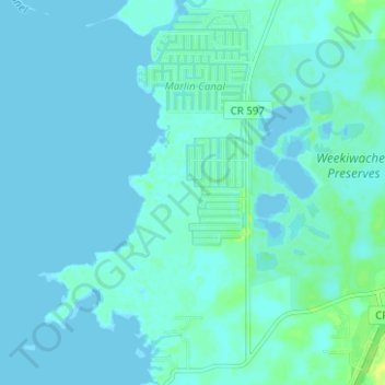
Name: Hernando Beach topographic map, elevation, terrain.
Location: Hernando Beach, Hernando County, Florida, United States (28.44924 -82.68430 28.50406 -82.64891)
Average elevation: 10 ft
Minimum elevation: -3 ft
Maximum elevation: 49 ft
Hernando County trails, hiking, mountain biking, running and outdoor activities
Other topographic maps
Click on a map to view its topography, its elevation and its terrain.
Weeki Wachee Spring
United States > Florida > Hernando County > Spring Hill > Weeki Wachee
Average elevation: 36 ft
Weeki Wachee Acres
United States > Florida > Hernando County > Weeki Wachee Acres
Average elevation: 36 ft