
Gober topographic map
Interactive map
Click on the map to display elevation.
About this map
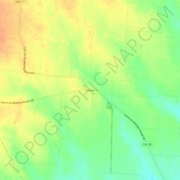
Name: Gober topographic map, elevation, terrain.
Location: Gober, Fannin County, Texas, 75443, United States (33.44910 -96.10936 33.48910 -96.06936)
Average elevation: 653 ft
Minimum elevation: 581 ft
Maximum elevation: 709 ft
Fannin County trails, hiking, mountain biking, running and outdoor activities
Other topographic maps
Click on a map to view its topography, its elevation and its terrain.
Honey Grove
United States > Texas > Fannin County
Honey Grove is in central North Texas, in eastern Fannin County, 16 miles (26 km) east of Bonham, the county seat, 39 miles (63 km) north of Greenville, 42 miles (68 km) east of Sherman, and 90 miles (140 km) northeast of the central business district of Dallas. Honey Grove was developed on flat to gently…
Average elevation: 640 ft