
Apollo Beach topographic map
Interactive map
Click on the map to display elevation.
Apollo Beach
The history of Apollo Beach started in 1923 on land owned by the Dickman family, then used annually for farming and grazing pasture. Much of the land was mangrove and low-elevation and was considered uninhabitable.
About this map
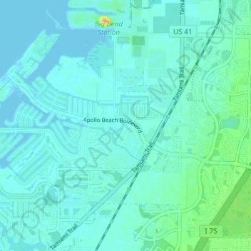
Name: Apollo Beach topographic map, elevation, terrain.
Average elevation: 20 ft
Minimum elevation: -10 ft
Maximum elevation: 115 ft
Hillsborough County trails, hiking, mountain biking, running and outdoor activities
Other topographic maps
Click on a map to view its topography, its elevation and its terrain.
Club Manor East of Grand Hampton
United States > Florida > Hillsborough County > Tampa
Average elevation: 56 ft
Arbors at Freedom Plaza
United States > Florida > Hillsborough County > Sun City Center
Average elevation: 49 ft
Hillsborough Heights East
United States > Florida > Hillsborough County > Tampa
Average elevation: 59 ft
Lutz
United States > Florida > Hillsborough County > Tampa
Lutz is characterized by a gently rolling topography that showcases the distinctive features of the central Florida landscape. The area has an average elevation of about 70 feet (21 meters) above sea level, contributing to its mild undulations rather than dramatic elevation changes. The terrain is marked by a…
Average elevation: 66 ft
The Borghese Villas at Westshore
United States > Florida > Hillsborough County > Tampa
Average elevation: 30 ft
Northpointe at Bayshore
United States > Florida > Hillsborough County > Tampa
Average elevation: 13 ft
Carrollwood
United States > Florida > Hillsborough County > Tampa
Carrollwood is located at 28.1 degrees north, 82.5 degrees west (28.0523, -82.4858). The elevation for the community is 39 feet (12 m) above sea level.
Average elevation: 52 ft
Carrollwood
United States > Florida > Hillsborough County > Tampa
Carrollwood is located at 28.1 degrees north, 82.5 degrees west (28.0523, -82.4858). The elevation for the community is 39 feet (12 m) above sea level.
Average elevation: 52 ft
Egypt Lake-Leto
United States > Florida > Hillsborough County
Egypt Lake-Leto is located in northwestern Hillsborough County at 28°0′55″N 82°30′26″W / 28.01528°N 82.50722°W / 28.01528; -82.50722 (28.015396, -82.507311), 7 miles (11 km) northwest of downtown Tampa. The elevation for the CDP is 45 feet (14 m) above sea level.
Average elevation: 49 ft
Alafia River Estates
United States > Florida > Hillsborough County > Riverview
Average elevation: 30 ft
Hillsborough Heights East
United States > Florida > Hillsborough County > Tampa
Average elevation: 59 ft
Alafia River Country Meadows
United States > Florida > Hillsborough County > Riverview
Average elevation: 33 ft
Citrus Park Crossing
United States > Florida > Hillsborough County > Citrus Park
Average elevation: 36 ft