
Menchum topographic map
Interactive map
Click on the map to display elevation.
About this map
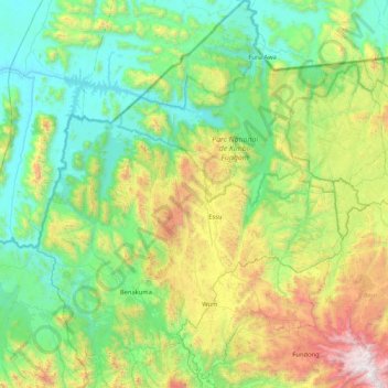
Name: Menchum topographic map, elevation, terrain.
Location: Menchum, Northwest, Cameroon (6.20798 9.70443 7.03875 10.45407)
Average elevation: 2,454 ft
Minimum elevation: 528 ft
Maximum elevation: 8,317 ft
Other topographic maps
Click on a map to view its topography, its elevation and its terrain.