
Coloma topographic map
Interactive map
Click on the map to display elevation.
About this map
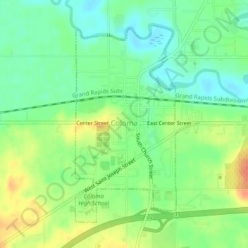
Name: Coloma topographic map, elevation, terrain.
Location: Coloma, Berrien County, Michigan, United States (42.17529 -86.31556 42.19676 -86.29729)
Average elevation: 656 ft
Minimum elevation: 594 ft
Maximum elevation: 741 ft
Berrien County trails, hiking, mountain biking, running and outdoor activities
Other topographic maps
Click on a map to view its topography, its elevation and its terrain.
Grand Mere State Park
United States > Michigan > Berrien County > Lincoln Charter Township
Average elevation: 607 ft
Grand Mere State Park
United States > Michigan > Berrien County > Stevensville
Average elevation: 607 ft
Grand Mere State Park
United States > Michigan > Berrien County > Stevensville
Average elevation: 607 ft