
Dungannon topographic map
Interactive map
Click on the map to display elevation.
About this map
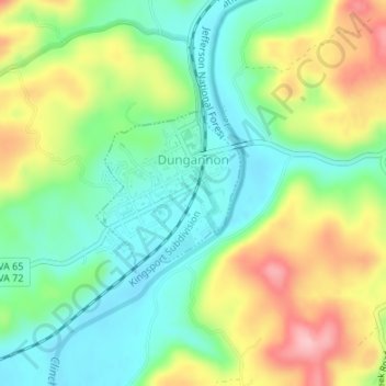
Name: Dungannon topographic map, elevation, terrain.
Location: Dungannon, Scott County, Virginia, 24245, United States (36.82225 -82.47455 36.83376 -82.46192)
Average elevation: 1,470 ft
Minimum elevation: 1,270 ft
Maximum elevation: 1,795 ft
Scott County trails, hiking, mountain biking, running and outdoor activities
Other topographic maps
Click on a map to view its topography, its elevation and its terrain.