
Smyrna topographic map
Interactive map
Click on the map to display elevation.
About this map
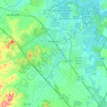
Name: Smyrna topographic map, elevation, terrain.
Average elevation: 577 ft
Minimum elevation: 479 ft
Maximum elevation: 965 ft
Rutherford County trails, hiking, mountain biking, running and outdoor activities
Other topographic maps
Click on a map to view its topography, its elevation and its terrain.
Loafer's Corner
United States > Tennessee > Rutherford County > Smyrna > Smyrna
Average elevation: 600 ft
Barfield Crescent Park
United States > Tennessee > Rutherford County > Murfreesboro
Average elevation: 659 ft
BAttlefield Meadows
United States > Tennessee > Rutherford County > Murfreesboro
Average elevation: 568 ft
Brownview Acres
United States > Tennessee > Rutherford County > Murfreesboro > Brownview Acres
Average elevation: 617 ft