Geolocate

Jackson Center topographic map

Interactive map

Click on the map to display elevation.

About this map

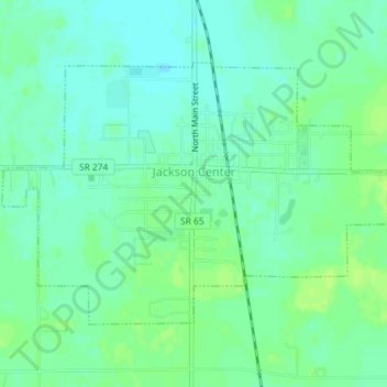
Name: Jackson Center topographic map, elevation, terrain.

Location: Jackson Center, Shelby County, Ohio, United States (40.42854 -84.05821 40.44719 -84.02202)

Average elevation: 1,030 ft

Minimum elevation: 1,010 ft

Maximum elevation: 1,053 ft

Other topographic maps

Click on a map to view its topography, its elevation and its terrain.

Lockington

United States > Ohio > Shelby County

Lockington, Shelby County, Ohio, United States

Average elevation: 928 ft

Plattsville

United States > Ohio > Shelby County

Plattsville, Shelby County, Ohio, United States

Average elevation: 1,089 ft

Ballou

United States > Ohio > Shelby County

Ballou, Shelby County, Ohio, 45317, United States

Average elevation: 1,109 ft

Fort Loramie

United States > Ohio > Shelby County

Fort Loramie, Shelby County, Ohio, United States

Average elevation: 958 ft

Sidney

United States > Ohio > Shelby County

Sidney, Shelby County, Ohio, 45365, United States

Average elevation: 1,024 ft

Sidney

United States > Ohio > Shelby County > Sidney > Sidney

Sidney, Shelby County, Ohio, 45365, United States

Average elevation: 1,024 ft

Russia

United States > Ohio > Shelby County

Russia, Shelby County, Ohio, United States

Average elevation: 978 ft