
Clyde River topographic map
Interactive map
Click on the map to display elevation.
About this map
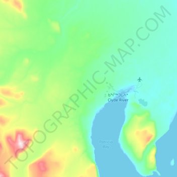
Name: Clyde River topographic map, elevation, terrain.
Location: Clyde River, Qikiqtaaluk Region, Nunavut, Canada (70.37628 -68.83233 70.57968 -68.28610)
Average elevation: 299 ft
Minimum elevation: -3 ft
Maximum elevation: 2,008 ft