
Noblesville topographic map
Interactive map
Click on the map to display elevation.
About this map
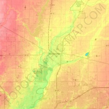
Name: Noblesville topographic map, elevation, terrain.
Location: Noblesville, Hamilton County, Indiana, 46060, United States (39.98673 -86.09055 40.10175 -85.86223)
Average elevation: 817 ft
Minimum elevation: 630 ft
Maximum elevation: 932 ft
Hamilton County trails, hiking, mountain biking, running and outdoor activities
Other topographic maps
Click on a map to view its topography, its elevation and its terrain.