
Kovachevo topographic map
Interactive map
Click on the map to display elevation.
About this map
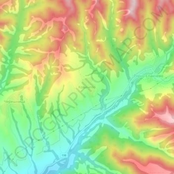
Name: Kovachevo topographic map, elevation, terrain.
Location: Kovachevo, Sandanski, Blagoevgrad, 2824, Bulgaria (41.47800 23.46201 41.51800 23.50201)
Average elevation: 1,296 ft
Minimum elevation: 735 ft
Maximum elevation: 1,982 ft
Other topographic maps
Click on a map to view its topography, its elevation and its terrain.
Goreme
Bulgaria > Blagoevgrad > Goreme
Goreme, Strumiani, Blagoevgrad, 2834, Bulgaria
Average elevation: 2,451 ft