
Flushing Meadows-Corona Park topographic map
Interactive map
Click on the map to display elevation.
Flushing Meadows-Corona Park
Around 1907, contractor Michael Degnon, whose firm constructed the Williamsburg Bridge, the Cape Cod Canal, and the Steinway subway tunnel (used by today's 7 and <7> trains), purchased large tracts of marsh near Flushing Creek. At the time, the land was considered "all but worthless". Degnon envisioned using the site to create a large industrial port around Flushing Bay, similar to a terminal he developed in Long Island City. By 1911, Degnon had created a plan along with the United States Department of War and the Queens Topographical Bureau. The plan envisioned widening Flushing River and creating docks for ships, with numerous factories and freight facilities. Meanwhile, the residential areas of Corona were expected to become the primary residence for factory workers.
About this map
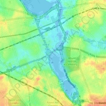
Name: Flushing Meadows-Corona Park topographic map, elevation, terrain.
Location: Flushing Meadows-Corona Park, New York, United States (40.71453 -73.86319 40.76675 -73.82557)
Average elevation: 49 ft
Minimum elevation: -23 ft
Maximum elevation: 131 ft
New York trails, hiking, mountain biking, running and outdoor activities
Other topographic maps
Click on a map to view its topography, its elevation and its terrain.
Manhattan Island
United States > New York > New York
Marble Hill is one example of how Manhattan's land has been considerably altered by human intervention. The borough has seen substantial land reclamation along its waterfronts since Dutch colonial times, and much of the natural variation in its topography has been evened out.
Average elevation: 56 ft
Washington Heights
United States > New York > New York
Because of their abrupt, hilly topography, pedestrian navigation in Upper Manhattan is facilitated by many step streets. The longest of these in Washington Heights, at approximately 130 stairs and with an elevation gain of approximately 65 feet, connects Fort Washington Avenue and Overlook Terrace at 187th…
Average elevation: 82 ft
New York County
United States > New York > New York
Marble Hill is one example of how Manhattan's land has been considerably altered by human intervention. The borough has seen substantial land reclamation along its waterfronts since Dutch colonial times, and much of the natural variation in its topography has been evened out.
Average elevation: 52 ft
Queens County
United States > New York > New York
Many of the village street grids of Queens had only worded names, some were numbered according to local numbering schemes, and some had a mix of words and numbers. In the early 1920s, a "Philadelphia Plan" was instituted to overlay one numbered system upon the whole borough. The Topographical Bureau, Borough…
Average elevation: 36 ft
Bronx County
United States > New York > New York
The Bronx's highest elevation at 280 feet (85 m) is in the northwest corner, west of Van Cortlandt Park and in the Chapel Farm area near the Riverdale Country School. The opposite (southeastern) side of the Bronx has four large low peninsulas or "necks" of low-lying land that jut into the waters of the East…
Average elevation: 69 ft