
Vresse-sur-Semois topographic map
Interactive map
Click on the map to display elevation.
About this map
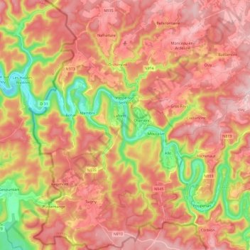
Name: Vresse-sur-Semois topographic map, elevation, terrain.
Location: Vresse-sur-Semois, Dinant, Namur, Wallonia, 5550, Belgium (49.78555 4.84754 49.93092 4.99057)
Average elevation: 1,076 ft
Minimum elevation: 502 ft
Maximum elevation: 1,467 ft
Other topographic maps
Click on a map to view its topography, its elevation and its terrain.