
Honesdale topographic map
Interactive map
Click on the map to display elevation.
About this map
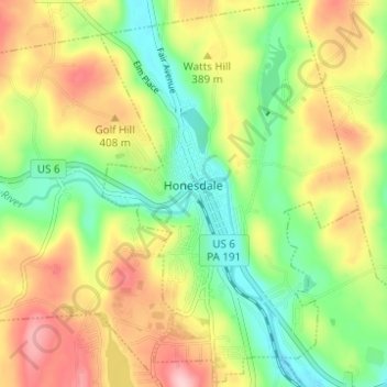
Name: Honesdale topographic map, elevation, terrain.
Location: Honesdale, Wayne County, Pennsylvania, 18431, United States (41.55261 -75.27300 41.59800 -75.23246)
Average elevation: 1,198 ft
Minimum elevation: 928 ft
Maximum elevation: 1,549 ft
Wayne County trails, hiking, mountain biking, running and outdoor activities
Other topographic maps
Click on a map to view its topography, its elevation and its terrain.
Forest City Station
United States > Pennsylvania > Wayne County > Forest City Station
Average elevation: 1,742 ft