
Daytona Beach topographic map
Interactive map
Click on the map to display elevation.
About this map
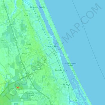
Name: Daytona Beach topographic map, elevation, terrain.
Location: Daytona Beach, Volusia County, Florida, United States (29.12883 -81.21154 29.26877 -80.98309)
Average elevation: 16 ft
Minimum elevation: -10 ft
Maximum elevation: 131 ft
Volusia County trails, hiking, mountain biking, running and outdoor activities
Other topographic maps
Click on a map to view its topography, its elevation and its terrain.
Samsula-Spruce Creek
United States > Florida > Volusia County > New Smyrna Beach > South Village
Average elevation: 26 ft
Halifax Estates
United States > Florida > Volusia County > Daytona Beach Shores
Average elevation: 3 ft