
Grapevine topographic map
Interactive map
Click on the map to display elevation.
About this map
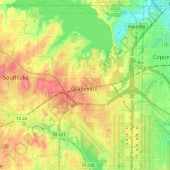
Name: Grapevine topographic map, elevation, terrain.
Location: Grapevine, Tarrant County, Texas, United States (32.87849 -97.12984 32.99364 -97.01569)
Average elevation: 577 ft
Minimum elevation: 459 ft
Maximum elevation: 709 ft
Tarrant County trails, hiking, mountain biking, running and outdoor activities
Other topographic maps
Click on a map to view its topography, its elevation and its terrain.