
Make a donation
Gear up for your next adventure:
As an Amazon Associate, this site earns from qualifying purchases at no extra cost to you.
Ocean City topographic map
Click on the map to display elevation.
Make a donation
Gear up for your next adventure:
As an Amazon Associate, this site earns from qualifying purchases at no extra cost to you.
About this map
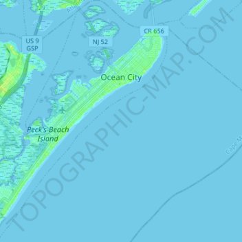
Name: Ocean City topographic map, elevation, terrain.
Location: Ocean City, Cape May County, New Jersey, United States (39.20802 -74.65491 39.31010 -74.54960)
Average elevation: 3 ft
Minimum elevation: -10 ft
Maximum elevation: 39 ft
Cape May County trails, hiking, mountain biking, running and outdoor activities
Make a donation
Gear up for your next adventure:
As an Amazon Associate, this site earns from qualifying purchases at no extra cost to you.
Other topographic maps
Click on a map to view its topography, its elevation and its terrain.
Make a donation
Gear up for your next adventure:
As an Amazon Associate, this site earns from qualifying purchases at no extra cost to you.
South Seaville
United States > New Jersey > Cape May County > Dennis Township
Average elevation: 23 ft