
Indian Cave State Park topographic map
Interactive map
Click on the map to display elevation.
About this map
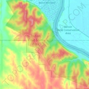
Name: Indian Cave State Park topographic map, elevation, terrain.
Location: Indian Cave State Park, Richardson County, Nebraska, USA (40.23329 -95.58414 40.28522 -95.51668)
Average elevation: 1,010 ft
Minimum elevation: 863 ft
Maximum elevation: 1,214 ft
Other topographic maps
Click on a map to view its topography, its elevation and its terrain.