
Jersey topographic map
Interactive map
Click on the map to display elevation.
About this map
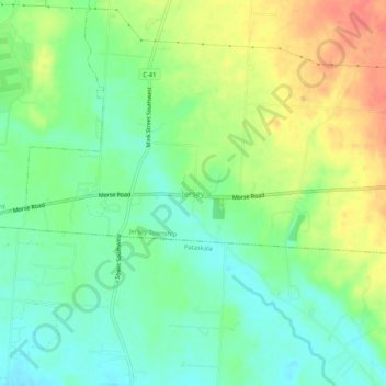
Name: Jersey topographic map, elevation, terrain.
Location: Jersey, Jersey Township, Licking County, Ohio, United States (40.03367 -82.74323 40.07367 -82.70323)
Average elevation: 1,135 ft
Minimum elevation: 1,060 ft
Maximum elevation: 1,247 ft
Licking County trails, hiking, mountain biking, running and outdoor activities
Other topographic maps
Click on a map to view its topography, its elevation and its terrain.
Infirmary Mound Park
United States > Ohio > Licking County > Granville > Union Station
Average elevation: 1,017 ft