
Make a donation
Gear up for your next adventure:
As an Amazon Associate, this site earns from qualifying purchases at no extra cost to you.
Abilene topographic map
Click on the map to display elevation.
Make a donation
Gear up for your next adventure:
As an Amazon Associate, this site earns from qualifying purchases at no extra cost to you.
Abilene
Abilene is at 38°55′11″N 97°13′2″W / 38.91972°N 97.21722°W / 38.91972; -97.21722 (38.919721, −97.217329) at an elevation of 1,155 feet (352 m). The city is on the north side of the Smoky Hill River in the Flint Hills region of the Great Plains. Mud Creek, a tributary of the Smoky Hill, flows south through the city. Located in North Central Kansas at the intersection of Interstate 70 and K-15, Abilene is approximately 27 mi (43 km) east of Salina, Kansas, 94 mi (151 km) north of Wichita, and 139 mi (224 km) west of Kansas City.
Make a donation
Gear up for your next adventure:
As an Amazon Associate, this site earns from qualifying purchases at no extra cost to you.
About this map
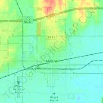
Name: Abilene topographic map, elevation, terrain.
Location: Abilene, Dickinson County, Kansas, United States (38.89601 -97.26351 38.94806 -97.19962)
Average elevation: 1,171 ft
Minimum elevation: 1,125 ft
Maximum elevation: 1,280 ft
Dickinson County trails, hiking, mountain biking, running and outdoor activities
Make a donation
Gear up for your next adventure:
As an Amazon Associate, this site earns from qualifying purchases at no extra cost to you.
Other topographic maps
Click on a map to view its topography, its elevation and its terrain.