
Chester topographic map
Interactive map
Click on the map to display elevation.
About this map
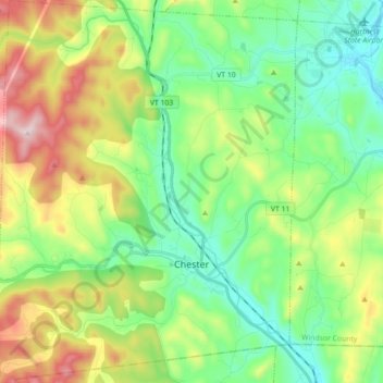
Name: Chester topographic map, elevation, terrain.
Location: Chester, Windsor County, Vermont, 05143, United States (43.22258 -72.68544 43.35197 -72.54544)
Average elevation: 1,040 ft
Minimum elevation: 433 ft
Maximum elevation: 2,283 ft
Windsor County trails, hiking, mountain biking, running and outdoor activities
Other topographic maps
Click on a map to view its topography, its elevation and its terrain.
Ascutney
United States > Vermont > Windsor County > Weathersfield > Ascutney
Average elevation: 548 ft