
Saint Johns Island topographic map
Interactive map
Click on the map to display elevation.
About this map
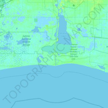
Name: Saint Johns Island topographic map, elevation, terrain.
Location: Saint Johns Island, Cameron Parish, Louisiana, United States (29.51244 -93.67627 30.15244 -93.03627)
Average elevation: 3 ft
Minimum elevation: -20 ft
Maximum elevation: 56 ft
Cameron Parish trails, hiking, mountain biking, running and outdoor activities
Other topographic maps
Click on a map to view its topography, its elevation and its terrain.
Hackberry
United States > Louisiana > Cameron Parish
Hackberry is located in north-central Cameron Parish at 29°59′11″N 93°23′50″W / 29.98639°N 93.39722°W / 29.98639; -93.39722 (29.986485, -93.397190), at an elevation of 8 feet (2.4 m) above sea level on the west side of Calcasieu Lake. Louisiana State Highway 27 passes through the CDP,…
Average elevation: 3 ft