
Hulunbuir topographic map
Interactive map
Click on the map to display elevation.
About this map
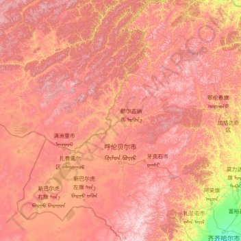
Name: Hulunbuir topographic map, elevation, terrain.
Location: Hulunbuir, Inner Mongolia, China (47.09442 115.52037 53.33406 125.32729)
Average elevation: 2,343 ft
Minimum elevation: 469 ft
Maximum elevation: 5,610 ft
Other topographic maps
Click on a map to view its topography, its elevation and its terrain.
Horqin Right Front Banner
China > Inner Mongolia > Horqin Right Front Banner > Ke'erqin
Average elevation: 1,142 ft