
Rockdale topographic map
Interactive map
Click on the map to display elevation.
About this map
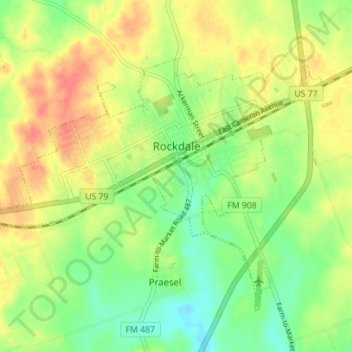
Name: Rockdale topographic map, elevation, terrain.
Location: Rockdale, Milam County, Texas, 76567, United States (30.62678 -97.04662 30.67274 -96.97681)
Average elevation: 482 ft
Minimum elevation: 397 ft
Maximum elevation: 574 ft
Milam County trails, hiking, mountain biking, running and outdoor activities
Other topographic maps
Click on a map to view its topography, its elevation and its terrain.