
Saint Ansgar topographic map
Interactive map
Click on the map to display elevation.
About this map
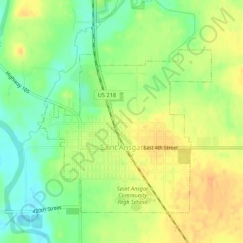
Name: Saint Ansgar topographic map, elevation, terrain.
Location: Saint Ansgar, Mitchell County, Iowa, United States (43.37110 -92.93145 43.39166 -92.90523)
Average elevation: 1,161 ft
Minimum elevation: 1,099 ft
Maximum elevation: 1,211 ft
Mitchell County trails, hiking, mountain biking, running and outdoor activities
Other topographic maps
Click on a map to view its topography, its elevation and its terrain.