
Presidio of San Francisco topographic map
Interactive map
Click on the map to display elevation.
About this map
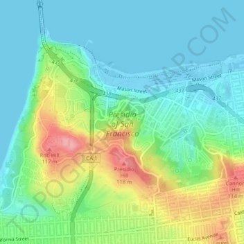
Name: Presidio of San Francisco topographic map, elevation, terrain.
Average elevation: 125 ft
Minimum elevation: -36 ft
Maximum elevation: 413 ft
California trails, hiking, mountain biking, running and outdoor activities
Other topographic maps
Click on a map to view its topography, its elevation and its terrain.
San Francisco Bay Area
United States > California > San Francisco
The San Francisco Bay Area is characterized by a diverse and dynamic topography shaped by geological processes over millions of years. This region features a combination of coastal plains, steep hills, and rugged mountains, all influenced by the tectonic activity associated with the nearby San Andreas Fault…
Average elevation: 371 ft
San Francisco Maritime National Historical Park
United States > California > San Francisco
Average elevation: 36 ft
San Francisco Bay Area
United States > California > San Francisco
The borders of the San Francisco Bay Area are not officially delineated, and the unique development patterns influenced by the region's topography, as well as unusual commute patterns caused by the presence of three central cities and employment centers located in various suburban locales, has led to…
Average elevation: 371 ft