
Huntington Township topographic map
Interactive map
Click on the map to display elevation.
About this map
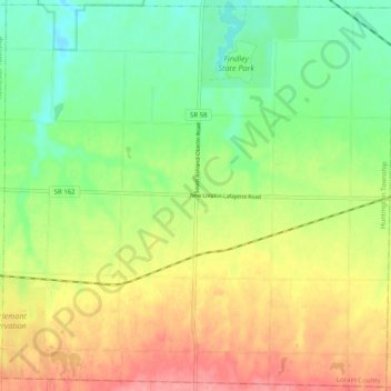
Name: Huntington Township topographic map, elevation, terrain.
Location: Huntington Township, Lorain County, Ohio, United States (41.06361 -82.27037 41.13768 -82.16988)
Average elevation: 974 ft
Minimum elevation: 850 ft
Maximum elevation: 1,132 ft
Lorain County trails, hiking, mountain biking, running and outdoor activities
Other topographic maps
Click on a map to view its topography, its elevation and its terrain.