
Franklin topographic map
Interactive map
Click on the map to display elevation.
About this map
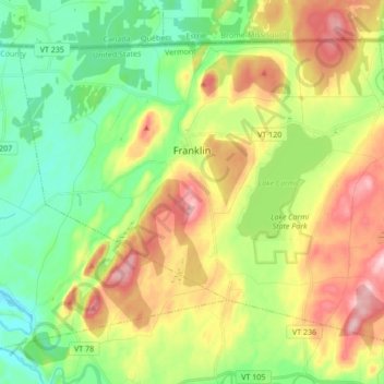
Name: Franklin topographic map, elevation, terrain.
Location: Franklin, Franklin County, Vermont, United States (44.92047 -72.99322 45.01667 -72.82235)
Average elevation: 466 ft
Minimum elevation: 187 ft
Maximum elevation: 889 ft
Franklin County trails, hiking, mountain biking, running and outdoor activities
Other topographic maps
Click on a map to view its topography, its elevation and its terrain.
Sheldon Springs
United States > Vermont > Franklin County > Sheldon
Sheldon Springs is an unincorporated community village in the town of Sheldon in Franklin County, Vermont, United States. It lies at an altitude of 299 feet (91 m). A post office was established in 1871.
Average elevation: 387 ft