
Ben Lomond topographic map
Interactive map
Click on the map to display elevation.
About this map
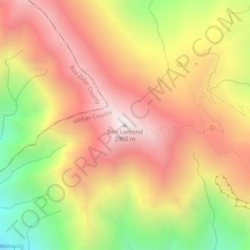
Name: Ben Lomond topographic map, elevation, terrain.
Location: Ben Lomond, Weber County, Utah, 84414, United States (41.36320 -111.96073 41.36330 -111.96063)
Average elevation: 8,048 ft
Minimum elevation: 5,850 ft
Maximum elevation: 9,685 ft
Weber County trails, hiking, mountain biking, running and outdoor activities
Other topographic maps
Click on a map to view its topography, its elevation and its terrain.