
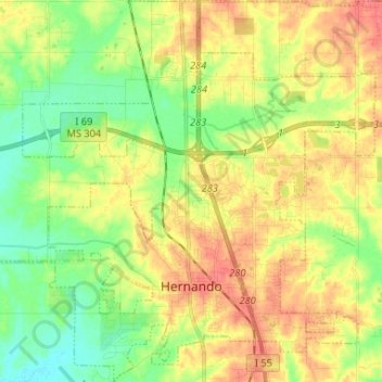
Hernando topographic map
Interactive map
Click on the map to display elevation.
About this map
Name: Hernando topographic map, elevation, terrain.
Location: Hernando, DeSoto County, Mississippi, United States (34.79672 -90.06023 34.90433 -89.93054)
Average elevation: 315 ft
Minimum elevation: 220 ft
Maximum elevation: 417 ft
DeSoto County trails, hiking, mountain biking, running and outdoor activities
Other topographic maps
Click on a map to view its topography, its elevation and its terrain.