
Gearhart topographic map
Interactive map
Click on the map to display elevation.
About this map
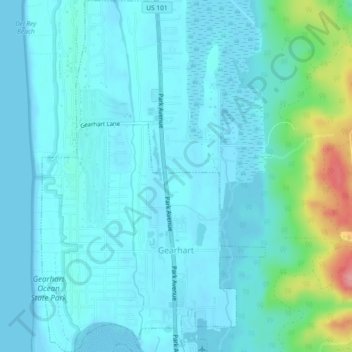
Name: Gearhart topographic map, elevation, terrain.
Location: Gearhart, Clatsop County, Oregon, United States (46.01503 -123.92888 46.04687 -123.89959)
Average elevation: 56 ft
Minimum elevation: -3 ft
Maximum elevation: 361 ft
Clatsop County trails, hiking, mountain biking, running and outdoor activities
Other topographic maps
Click on a map to view its topography, its elevation and its terrain.
Fort Stevens
United States > Oregon > Clatsop County > Hammond > Fort Stevens
Average elevation: 10 ft