
Eastman topographic map
Interactive map
Click on the map to display elevation.
About this map
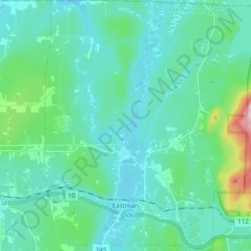
Name: Eastman topographic map, elevation, terrain.
Location: Eastman, Memphrémagog, Estrie, Quebec, J0E 1P0, Canada (45.28441 -72.35806 45.37712 -72.24738)
Average elevation: 1,030 ft
Minimum elevation: 791 ft
Maximum elevation: 2,379 ft
Other topographic maps
Click on a map to view its topography, its elevation and its terrain.
Ayers Cliff Exposition Grounds
Canada > Quebec > Memphrémagog > Ayer's Cliff
Ayers Cliff Exposition Grounds, Ayer's Cliff, Memphrémagog, Estrie, Quebec, Canada
Average elevation: 571 ft
Mont Éléphant
Canada > Quebec > Memphrémagog > Potton
Mont Éléphant, Potton, Memphrémagog, Estrie, Quebec, Canada
Average elevation: 1,276 ft
Mont Hawk
Canada > Quebec > Memphrémagog > Potton
Mont Hawk, Potton, Memphrémagog, Estrie, Quebec, Canada
Average elevation: 1,132 ft
Mont Singer
Canada > Quebec > Memphrémagog > Potton
Mont Singer, Potton, Memphrémagog, Estrie, Quebec, Canada
Average elevation: 1,978 ft
Magog
Canada > Quebec > Memphrémagog
Magog, Memphrémagog, Estrie, Quebec, Canada
Average elevation: 820 ft
Lake Memphremagog
Canada > Quebec > Memphrémagog > Stanstead (Canton)
Lake Memphremagog, Stanstead (Canton), Memphrémagog, Estrie, Quebec, Canada
Average elevation: 1,020 ft