
Cottonwood topographic map
Interactive map
Click on the map to display elevation.
About this map
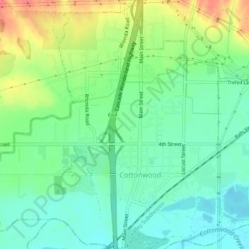
Name: Cottonwood topographic map, elevation, terrain.
Location: Cottonwood, Shasta County, California, United States (40.37700 -122.30725 40.40618 -122.26877)
Average elevation: 459 ft
Minimum elevation: 384 ft
Maximum elevation: 597 ft
Shasta County trails, hiking, mountain biking, running and outdoor activities
Other topographic maps
Click on a map to view its topography, its elevation and its terrain.
Shasta
United States > California > Shasta County
Shasta is a census-designated place (CDP) in Shasta County, California, United States. Shasta sits at an elevation of 843 feet (257 m). Its population is 1,043 as of the 2020 census, down from 1,771 from the 2010 census.
Average elevation: 1,152 ft
Cassel
United States > California > Shasta County
Cassel is a census-designated place (CDP) in Shasta County, California. Cassel sits at an elevation of 3,176 feet (968 m). Its population is 207 as of the 2020 census, remaining the same from the 2010 census. The ZIP Code is 96016. The community is inside area code 530.
Average elevation: 3,189 ft
Redding
United States > California > Shasta County > Redding
The elevation in Redding is 495 feet (151 meters) on average, whereas anywhere to the north, east, or west of downtown ranges between 550 feet (170 m) and 800 feet (240 m) feet. Southern portions range between 400 feet (120 m) and 500 feet (150 m).
Average elevation: 1,024 ft