
St. Donatus topographic map
Click on the map to display elevation.
About this map
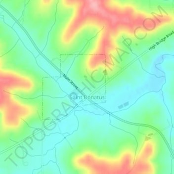
Name: St. Donatus topographic map, elevation, terrain.
Location: St. Donatus, Jackson County, Iowa, United States (42.35731 -90.54888 42.36738 -90.53556)
Average elevation: 755 ft
Minimum elevation: 617 ft
Maximum elevation: 994 ft
Jackson County trails, hiking, mountain biking, running and outdoor activities
Other topographic maps
Click on a map to view its topography, its elevation and its terrain.
Springbrook
United States > Iowa > Jackson County > Springbrook > Springbrook
Average elevation: 807 ft