
Nordegg topographic map
Interactive map
Click on the map to display elevation.
About this map
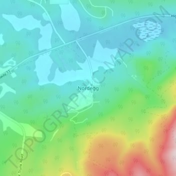
Name: Nordegg topographic map, elevation, terrain.
Location: Nordegg, Clearwater County, Alberta, T0M 2H0, Canada (52.45374 -116.09313 52.49374 -116.05313)
Average elevation: 4,590 ft
Minimum elevation: 4,278 ft
Maximum elevation: 5,584 ft
Other topographic maps
Click on a map to view its topography, its elevation and its terrain.
Sentinel Mountain
Canada > Alberta > Clearwater County
Sentinel Mountain, Clearwater County, Alberta, Canada
Average elevation: 6,909 ft