Geolocate

Sentinel Mountain topographic map

Click on the map to display elevation.

About this map

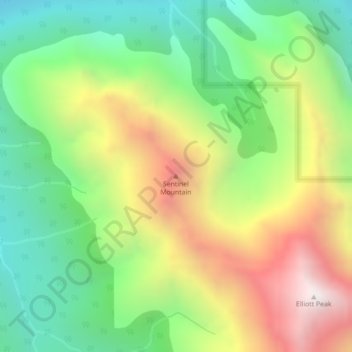
Name: Sentinel Mountain topographic map, elevation, terrain.

Location: Sentinel Mountain, Clearwater County, Alberta, Canada (52.13725 -116.49228 52.13735 -116.49218)

Average elevation: 6,909 ft

Minimum elevation: 5,174 ft

Maximum elevation: 9,419 ft

Gear up for your next adventure:

🔦Compact Flashlight - Reliable flashlight for emergencies
🏕️Tent Footprint - Protect your tent base from wear
📖Nature Tracking Books - Learn to track wildlife and terrain
📶Satellite Messenger - Communication device off‑grid
🪶LED Camping Lantern - Bright lantern for camp lighting

As an Amazon Associate, this site earns from qualifying purchases at no extra cost to you.