
McLeansboro topographic map
Interactive map
Click on the map to display elevation.
About this map
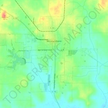
Name: McLeansboro topographic map, elevation, terrain.
Location: McLeansboro, Hamilton County, Illinois, 62859, United States (38.07125 -88.57136 38.10418 -88.51144)
Average elevation: 453 ft
Minimum elevation: 387 ft
Maximum elevation: 564 ft
Hamilton County trails, hiking, mountain biking, running and outdoor activities
Other topographic maps
Click on a map to view its topography, its elevation and its terrain.