
Ranger topographic map
Interactive map
Click on the map to display elevation.
About this map
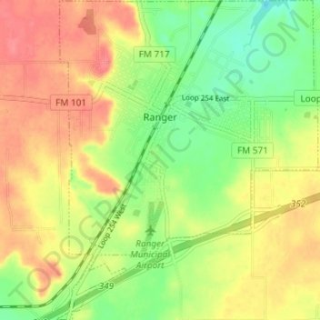
Name: Ranger topographic map, elevation, terrain.
Location: Ranger, Eastland County, Texas, 76470, United States (32.43691 -98.69959 32.48798 -98.65004)
Average elevation: 1,493 ft
Minimum elevation: 1,381 ft
Maximum elevation: 1,598 ft
Eastland County trails, hiking, mountain biking, running and outdoor activities
Other topographic maps
Click on a map to view its topography, its elevation and its terrain.