
Hornbrook topographic map
Interactive map
Click on the map to display elevation.
About this map
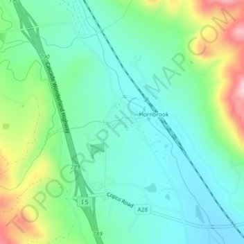
Name: Hornbrook topographic map, elevation, terrain.
Location: Hornbrook, Siskiyou County, California, United States (41.89764 -122.57414 41.92087 -122.54087)
Average elevation: 2,310 ft
Minimum elevation: 2,093 ft
Maximum elevation: 2,858 ft
Siskiyou County trails, hiking, mountain biking, running and outdoor activities
Other topographic maps
Click on a map to view its topography, its elevation and its terrain.
Klamath River
United States > California > Siskiyou County > Klamath River
Average elevation: 2,464 ft