
Carrabassett Valley topographic map
Interactive map
Click on the map to display elevation.
About this map
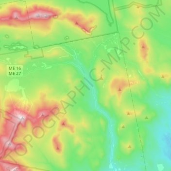
Name: Carrabassett Valley topographic map, elevation, terrain.
Average elevation: 1,624 ft
Minimum elevation: 449 ft
Maximum elevation: 4,199 ft
Franklin County trails, hiking, mountain biking, running and outdoor activities
Other topographic maps
Click on a map to view its topography, its elevation and its terrain.
Height of Land Scenic Overlook
United States > Maine > Franklin County > Township D > Rangeley Plantation
Average elevation: 1,972 ft
Sandy River Plantation
United States > Maine > Franklin County > Sandy River Plantation
Average elevation: 1,932 ft