Geolocate

Rocky Mountain National Park topographic map

Interactive map

Click on the map to display elevation.

About this map

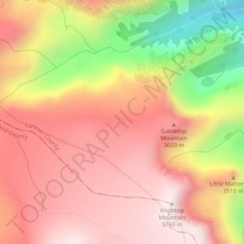
Name: Rocky Mountain National Park topographic map, elevation, terrain.

Location: Rocky Mountain National Park, Larimer County, Colorado, USA (40.33327 -105.70895 40.33337 -105.70885)

Average elevation: 11,312 ft

Minimum elevation: 9,619 ft

Maximum elevation: 12,313 ft

Other topographic maps

Click on a map to view its topography, its elevation and its terrain.

Aurora Reservoir

USA > Colorado > Aurora

Average elevation: 5,945 ft

San Isabel National Forest

USA > Colorado > Cuchara

Average elevation: 7,349 ft

Idaho Springs

USA > Colorado > Idaho Springs

Average elevation: 8,189 ft

Uncompahgre National Forest

USA > Colorado > Pandora

Average elevation: 8,724 ft

Pike National Forest

USA > Colorado

Average elevation: 8,648 ft

Commerce City

USA > Colorado > Commerce City

Average elevation: 5,125 ft

Cherry Creek Reservoir

USA > Colorado

Average elevation: 5,561 ft

Bennett

USA > Colorado > Bennett

Average elevation: 5,528 ft

Saint Vrain

USA > Colorado

Average elevation: 4,793 ft

Haviland Lake

USA > Colorado > Tacoma

Average elevation: 8,287 ft

Kiln Creek

USA > Colorado

Average elevation: 9,695 ft